
TIME: 1H 48M
LENGTH: 2.7 MILES
ELEVATION: 899 ft
WHAT’S UP!
It’s been so long since I’ve done a local trail! So I was really happy to drive up to the Bear Mountain area and tackle this one. It took us 1H 48M but that includes time we used to take pictures and hang out on the money spot. I’m going to have to go back and do it start to finish without picture breaks to give you a real hike time. I’ll make sure to update this post when I do!
HIKE INFO
We parked right on the road on 9D and walked up to this trailhead.

Here’s a close up of the Appalachian trail map from the Hudson River to Connecticut. HERE’s a great website for an interactive map for the whole thing. I have to admit I think it’s pretty cool we have the ability to hike a small portion of this hike. Maybe, just maybe, one day I’ll do one of these long trails start to end…

So awesome to spot this trail marker 🙂

So… up we go. The first section is a bunch of “stairs” that are essentially very well placed rocks. We climbed for a little more than half a mile following the white trail blazers.

Afterwards you’ll come across this tree with three blue trail blazers. Make a right here and go up the now much easier portion of the trail. You can see Nicole and Kelly below stopping to wait for me to take my pictures 🙂

It’s pretty easy strolling from here on out. In the picture below you can see the trail heading towards a small pond. More on that later!

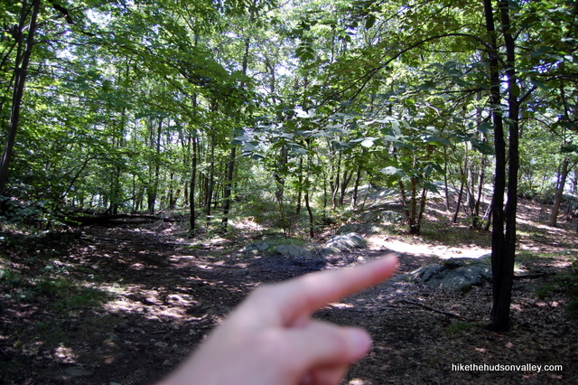
I totally forgot to take a picture of the junction where you need to make a right to get to the money spot. So here’s a picture from my favorite hiking blog Hike The Hudson to show you where to make the right. This junction will be where the blue trail makes a left but you’ll be making the right.
And then Boom! The money spot! Nicole took this awesome picture of me and Bear Mountain bridge. To the left of the bridge is the zoo and to the right of the bridge is the Rte 9W bridge that goes over Popolopen creek.

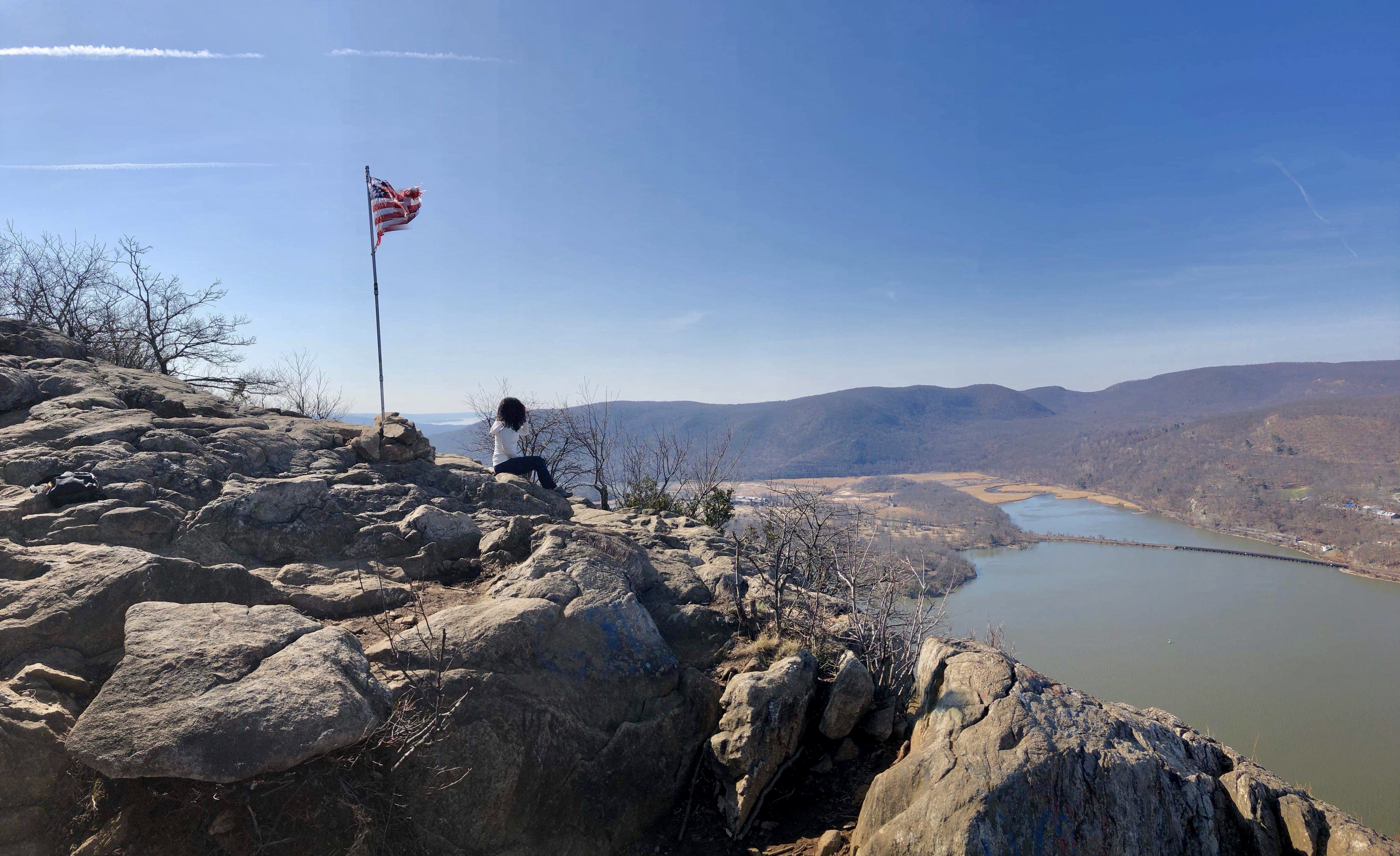
Here’s what the view looks like facing south. Kelly was in perfect position for a very patriotic picture. I love how American flags are erected at most hikes around the Hudson River.
Also, doggy! Really wish I would’ve been able to pet him. Doesn’t he look majestic posing for the picture?

So on the way down we just retraced our steps. This time we stopped at the little pond we walked past on the way up and took some time for important stuff: being very silly .

And then I spotted something.

I could not believe I found frog eggs. I wasn’t even sure that’s what I was looking at. But then a bunch of tadpoles swam around and we were certain they were. HERE’s a quick link for reference with pictures. We even spotted salamanders today.


Like I said, retrace your steps all the way down. Or up lol. The trail goes up and down until you hit those “stairs” again. Then it’s down to the trail head and your car. I had two bananas waiting in there for me. I hope if you go you have snacks waiting for you too.

I follow this awesome blog for hike ideas called Hike the Hudson. If you’re interested in reading his version of this hike, click HERE. Otherwise, here are some awesome pictures we took while hanging on Anthony’s Nose. I’m looking forward to doing it again this summer.


“Let’s play hide and seek in the mountains”
-Unknown

Pingback: MANITOU POINT PRESERVE – SALVI NOMAD
Pingback: MANITOU POINT PRESERVE – EN ESPAÑOL – SALVI NOMAD